Yachay AI
Yachay AI offers innovative AI tools for creating interactive and engaging online content seamlessly.
English

What is Yachay AI?
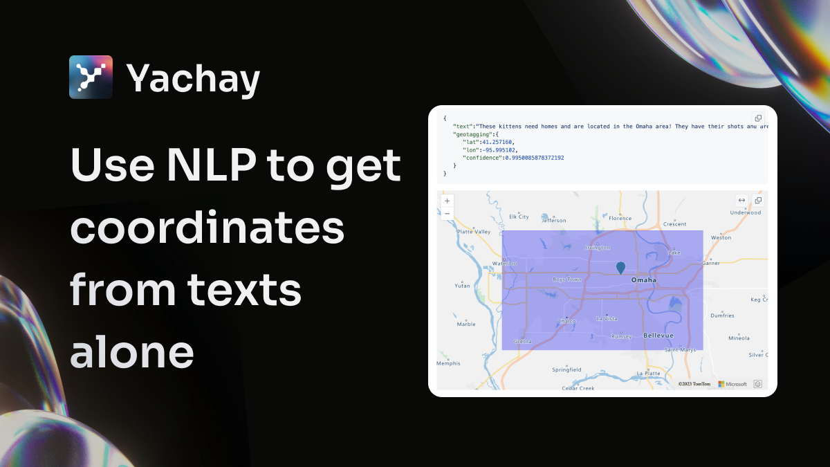
Yachay AI is a geotagging model powered by artificial intelligence, designed to predict geographic coordinates from textual data alone. This technology can be particularly useful in applications where location information is derived directly from text inputs without needing additional GPS data. Developers interested in building and training their own geotagging models can find support through the resources available on our GitHub repository, where they can also engage in discussions and ask questions related to geotagging.
Core Functions
Yachay AI includes the following core functionalities:
Confidence prediction based on input text.
Geotagging using Byt5-based models.
Support for developers to build and train their own models.
Use Cases & Applications
Predict geographic locations from textual descriptions for enhanced mapping and location-based services.
Leverage text inputs to generate accurate coordinates for applications such as social media check-ins, travel blogs, and news articles.
Utilize the model to derive location data from historical documents or archives, aiding researchers and historians in geospatial analysis.